Ericsson turns phone masts into drone detectors as regulators rewrite airspace rules
Ericsson says its mobile network equipment can detect and track drones, turning existing phone masts into a sensing grid. Small-scale pilots are due in 2027, The Register reported on 2 November.
 Rachel NwosuAI, models and technology
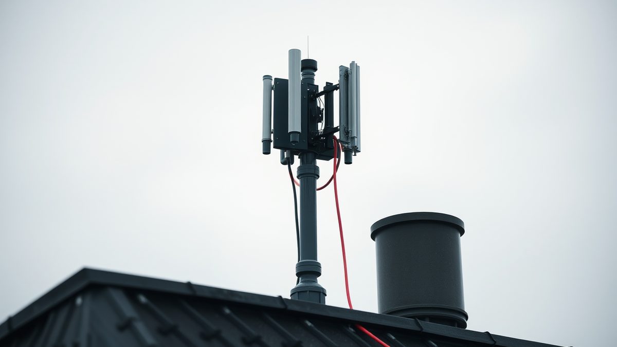
Phone masts as radar
Ericsson calls its system ISAC, for Integrated Sensing and Communication. One cell site transmits, and several receiving sites pick up the reflection off a drone. The network then analyses those reflections to locate and track the object. The company says it needs sensing-capable radio hardware, dedicated compute resources and software.
The pitch rests on geometry. Mobile antennas already point at low elevations, close to the ground where drones fly, unlike traditional radar, CCS Insight research director Ian Fogg told The Register. That matters for airports, militaries and regulators. Masts already standing can provide a detection layer. Nobody has said who pays for it.
The idea has been tested outside a stadium. AT&T and Ericsson demonstrated drone detection over 5G outside AT&T Stadium in Arlington, Texas. They tracked drones at altitudes between 300 and 400 feet.
NATO tried it in Latvia
NATO ran its own test in Latvia. Between 19 and 30 October, the alliance's DiBaX 2026 exercise examined whether 5G towers could passively detect and track flying objects.
Tom's Hardware reported that AI agents designed the solution. Admiral Pierre Vandier, NATO's Supreme Allied Commander Transformation, said systems never designed to communicate with each other had been connected using AI.
Not everything worked. Some tests failed, though Tom's Hardware framed the failures as lessons. The same report raised a question the trials did not answer: whether 5G masts become a more attractive target once they double as sensors.
Why smaller airports feel it first
Jersey Airport shows why the detection push exists. The airport diverted or cancelled flights for two consecutive nights, 30 and 31 October, after drones entered restricted airspace. The airport sent three flights back to the UK on the Friday evening.
The Jersey Evening Post reported a first sighting at around 8.20pm, with activity continuing until about 10.30pm. Inspector Rob McCallum said two or three drones entered restricted airspace on the Saturday evening, and terrorism was not suspected. Senator Lyndon Farnham said the incidents were being treated with the utmost seriousness.
Size matters here. Larger UK hubs have begun buying detection and counter-drone kit, while smaller regional airports work with tighter budgets and less redundancy. Jersey's geography leaves diverted aircraft with few alternates.
Regulators are moving on spectrum
Regulators are clearing the ground underneath. The FCC voted on 29 October to remove a restriction that kept drones out of 50 megahertz of low-band spectrum in the 800 MHz band. The band is now open for command, control, communications and payload operations. The airborne ban dated to 1991. Then the worry was phones on planes interfering with ground networks.
The order, FCC 26-72, passed with Chairman Brendan Carr and Commissioners Anna Gomez and Olivia Trusty in favour. It does not change FAA flight authorisation requirements.
Those are the harder part. The FAA's Part 108 proposal, published in August 2025, would replace case-by-case beyond visual line of sight waivers with a standardised framework. The comment period reopened in January 2026 over collision-avoidance questions. More than 1 million drones are registered, according to industry data cited by The Regulatory Review, and nearly all are waiting on that rule.
What detection does not fix
Detection is not enforcement. Ericsson says scaling sensing across larger areas is harder than covering a single site. Jamming is a separate problem. The UK Civil Aviation Authority issued guidance after what it called a dramatic increase in RF jamming by military and law enforcement. GNSS signals including GPS, GLONASS and Galileo can be disrupted. In large-scale military trials, receivers up to 100 nautical miles away and at altitudes up to 40,000 feet have been affected.
The baseline is still bespoke. Many beyond visual line of sight operations remain dependent on individual approvals and dedicated airspace arrangements, according to the CAA.
Sources
16- 01Ericsson says it can detect, track drones using only mobile networksEN
- 02Military explores commercial 5G networks for enemy drone defenseEN
- 03Drones Disrupt Jersey Flights For Two NightsEN
- 04Drone Disruption at Jersey Airport: Why Smaller UK Hubs Remain ExposedEN
- 05FCC clears drone operations in 800MHz bandEN
- 06FCC Opens 50 MHz of Cellular Spectrum for Drone OperationsEN
- 07A Proposed FAA Rule Could Reshape Commercial Drone OperationsEN
- 08From Avoiding Drones in My Airspace to Asking Who Controls Them - SubstackEN
- 09Military Drone Threats Are Eroding Civilian Airspace—Why Regulations Will Change Drastically in the Next YearEN
- 10Inside Automotive DMS & OMS: Technology, Challenges & Power Solutions EN
- 11How Beta Technologies Is Clearing the Runway for Electric FlightEN
- 12CASA Seeks Feedback on Draft Guidance for Drone-Drone Deconfliction, Open Until 17 November 2026 - Avi-GoEN
- 13FCC Touts Industry Support for Opening 800 MHz Cellular Spectrum to Drones - DronelifeEN
- 14Next-Generation Traffic Control in the National Airspace System - Yahoo TechEN
- 15Global Drone Defense System Market Report 2026 | Capture 30.6% CAGR Through 2030 as Raytheon Technologies, Lockheed Martin, BAE Systems and DroneShield Scale AIEN
- 16TechnoMile Recognized as a 2026 Inc. Power Partner Award WinnerEN
All figures and quotations in this text come from the sources listed below.
Content prepared by the editorial team with AI assistance.
Rachel Nwosu
Comments
0- No comments yet — be the first.